Navigating the River: Cataracts, Rapids and Tranquil Waters
Notwithstanding its many rapids and waterfalls, much of the Androscoggin is navigable, especially by small boats or those with a shallow draft. Canoeing, of course, has been taking place on the river and its tributaries for many centuries, but a handful of steamboats have also plied these waters. Besides the local vessels featured on this panel, several other steamers have traveled over the surface of the Androscoggin—including ones used solely on the lower river as early as 1819 and as late as 1855 (the eighty-foot long “Victor” was launched that year at Topsham). On rare occasions, even larger craft have been seen on the river; according to a 1970 history of Lisbon, Maine, “About the year 1802, a vessel of sixty-three tons was built at Lisbon by a Captain Woodward and launched into the river during high water, and brought down the river as far as the booms above the upper dam in Brunswick. Here she was taken out of the water and hauled on rollers through the woods to what is now McKeen Street, then down Main Street to the Cove where she was again launched into the river and remained in service for about twenty-five years. . . . One-hundred oxen were employed in hauling the vessel over land.”
No “Surprise”?
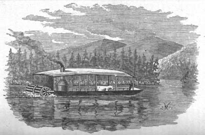
According to the Oxford Democrat, a weekly western Maine newspaper, the "Androscoggin Steam Navigation Company" was incorporated in 1853 and was to have exclusive navigation rights from Canton Point to Rumford Falls for a twenty-five year period. The Company issued a capital of $50,000 and secured Hiram Ricker of Poland Spring to support construction of the side-wheeler "The Surprise." As the paper reported it, on its maiden voyage, the vessel nearly capsized when its machinery failed. Living up to its name, the steamer was soon thereafter taken apart and its engine used to power a nearby mill. Needless to say, the company's stockholders must have suffered greatly.
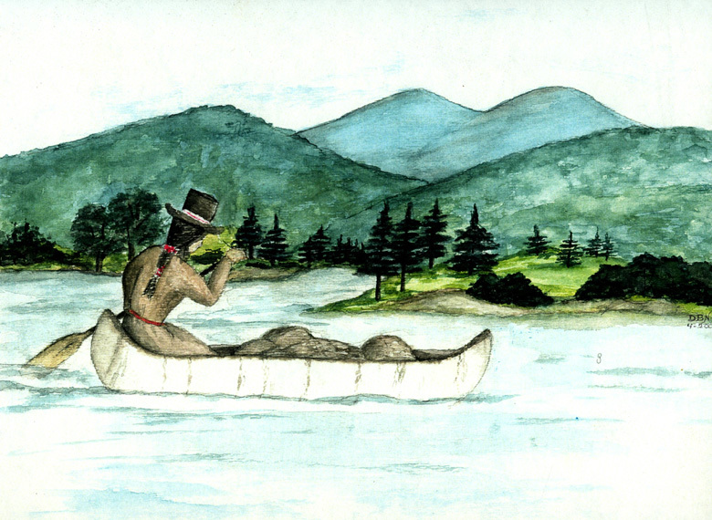
Like other Native Americans inhabiting northern New England, the Indians of the Androscoggin valley were a semi-nomadic people, moving easily up and down river in light birchbark canoes. Today, canoe trips and races on the river carry on this ancient tradition.
The stern-paddlewheel steamer "Union,” launched onto Umbagog Lake at Upton, Maine, in 1861, was the first vessel of its type to operate on the uppermost section of the Androscoggin above Errol Dam. It was also the first in a succession of steamboats that transported sportsmen and pleasure parties to and from the Umbagog region's renowned fishing and hunting grounds.
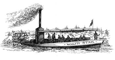
Nearly fifty feet long and capable of carrying fifty passengers, the "North Star," was launched from the Hanover ferry landing in March of 1889, and on its trial trip made it to the docking site at Alder River in Bethel. The steamboat is reported to have made trips daily from Bethel Hill to Hastings' Ferry (near the present Route 2 "Androscoggin" rest area), but the hazard of annual log drives on the Androscoggin, coupled with severe droughts in the summers of 1892 and '93, greatly hindered its use. Added to these obstacles was the fact that the "Rips" at Newry Corner could only be negotiated at high water. By May of 1894 this steamboat had been "dry-docked for an unlimited time." Though several of our oldest residents claim to have seen the "North Star" on the river after this time, the fate of the vessel remains unclear.
Androscoggin Canal Schemes
In its total length of about 175 miles, the river descends 1,245 feet—more than any other Maine river. The Androscoggin, as Walter Wells said in 1869, “is a water-power river its whole length, especially from Rumford Falls to Brunswick. It is navigable only from Merrymeeting Bay to the foot of Brunswick Falls, and there only for small craft. When President Timothy Dwight of Yale visited Maine in 1807, he wrote that the commerce of Brunswick was connected to the Kennebec River by means of the Androscoggin, which was navigable for small vessels to within two miles of the falls. . . . Some years later, Dr. Ezekiel Holmes noted that the Androscoggin had a difficult and troubled pathway, and had more rapids, falls, and cataracts than any other river of its size in Maine. Yet Androscoggin valley men struggled, vainly as it turned out, for the first fifty years of the nineteenth century to make a waterway of their river.
These men included Robert H. Gardiner of Gardiner, Edward Little of Auburn, and F. O. J. Smith of Portland. They and others had surveys made of their favorite schemes by such experienced civil engineers as Colonel Loammi Baldwin and his son Benjamin, both of Middlesex Canal fame; Colonel J. J. Abert of the U.S. Army Corps of Engineers; Captain James Hall of the Board of Internal Improvements; and Land Agent Noah Barker.
The earliest planning involved the lower river and the challenge posed by the high falls at Brunswick. Two later schemes related to the middle river and involved bypassing the falls at both Lewiston and Brunswick. The upper river inspired three amazing proposals: one to connect the Androscoggin and Connecticut rivers, another to connect the Androscoggin [at Bethel] with Portland by way of the Cumberland and Oxford Canal, and one to make an artificial outlet in [Lower] Richardson Lake to connect it directly with the Androscoggin—bypassing the river’s sixty-five-mile loop through New Hampshire.None of these schemes matured into construction [and] all attempts to canal, supplement or otherwise adapt the Androscoggin for transportation failed. In general, the failures must be charged to the number, height, and length of the falls, which were excellent for waterpower and industry but impossible for boating.
— Hayden L. V. Anderson, Canals and Inland Waterways of Maine (1982)


