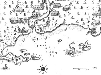
1613 Saco, Maine map
Title
1613 Saco, Maine map
Description
Like other Native Americans inhabiting northern New England, the Pigwackets were a semi-nomadic people, moving easily up and down river in light birchbark canoes in pursuit of sustenance. This 1613 map of Saco, Maine, by Samuel de Champlain includes Abenaki wigwams, longhouses, and cornfields used by the Pigwackets each spring when they left their winter hunting districts near Fryeburg to gather shellfish and other foods on the Atlantic shore. By her own account, Molly Ockett was born around 1740 on a point of land below the falls at Saco during one of these coastal sojourns.
Identifier
mollyockett-06

