Browse Items (74 total)

  • Collection: A River's Journey images
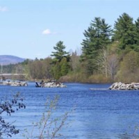
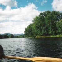
Canoeing on the Androscoggin

canoeing the river (Danna Nickerson photo).JPG

Still Image / Available Online

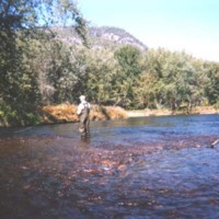
Remains of boom piers at Berlin

remains of boom piers at Berlin (Danna Nickerson photo).JPG

Still Image / Available Online

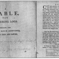
A table for measuring logs

Twitchell table for measuring logs.jpg

Still Image / Available Online

At the time of first settlement by white people, many towns on the Androscoggin boasted sizeable stands of white pine that thrived in the thin soils along the river’s banks. Eleazer Twitchell, a prominent Bethel resident, capitalized on this by…

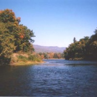
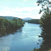
Androscoggin River near Gilead

AR near Gilead (Nate Wight photo).jpg

Still Image / Available Online

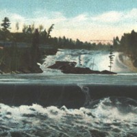
Upper and middle falls, Rumford

upper and middle falls, Rumford.jpg

Still Image / Available Online

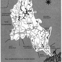
Map of the Androscoggin River watershed

Androscoggin watershed.jpg

Still Image / Available Online

A map of the Androscoggin River watershed. Though one of the largest rivers in Maine, the Androscoggin is unusual because it joins with the Kennebec River at Merrymeeting Bay (below Brunswick), rather than emptying directly into the Atlantic.

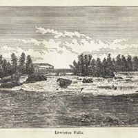
View of the falls between Lewiston and Auburn

Lewiston Falls (Water Power of Maine).jpg

Still Image / Available Online

Among the larger rivers in New England, the Androscoggin is by far the most unnavigable by vessels of any size, which explains why it was explored and permanently settled by white people later than other rivers in the region—and, more…

Androscoggin in North Bethel

AR at Bethel near Sunday River Road (looking south).jpg

Still Image / Available Online

Between the many waterfalls on the Androscoggin are numerous broad and calm stretches of water, which have become increasingly popular with modern-day canoeists. This segment flows through the picturesque countryside of North Bethel.

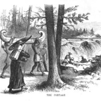
Native Americans at river portage

Indians at river portage.jpg

Still Image / Available Online

Over a period of many centuries, Native Americans established a system of trails and carrying places ("portages") throughout the Androscoggin watershed. On the subject of trails near the huge waterfalls at Rumford, Dr. William B. Lapham stated in…

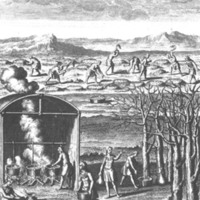
Native Americans boiling sap, etc.

Indians boiling sap, etc..jpg

Still Image / Available Online

Well before the time of first contact with Europeans, the Abenaki of the Androscoggin valley had developed a culture heavily dependent on agriculture, and at "Rockamecook" (Canton Point), some five hundred acres of corn grown on the Androscoggin…

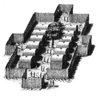
Native American stockade

Indian stockade.jpg

Still Image / Available Online

This early 17th century representation of an East Coast Algonquian village conveys an accurate picture of the type of fortified encampments that once dotted the Androscoggin River valley. In 1703, an English scouting party traveling through this…

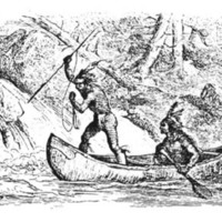
Native Americans spearing salmon at a falls

Indians spearing salmon at a falls.jpg

Still Image / Available Online

Before dams were constructed by white settlers, the Androscoggin teemed with fish, including thousands of Atlantic salmon that battled their way up the river and its tributaries each spring to spawn. The cold, clear waters of the river were also the…

Native American on snowshoes

Indian on snowshoes.jpg

Still Image / Available Online

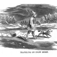
Throughout ancient times, the Androscoggin was a “great water road” to the Abenaki, both in summer and winter. During the colder months, the smooth ice on the river made travel up and down the valley much easier than over well-worn trails alongside…

Captain John Smith

Captain John Smith.jpg

Still Image / Available Online

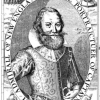
Among the earliest English explorers to venture up the Androscoggin was Captain Raleigh Gilbert. In September 1607 he and his men rowed longboats upriver from Brunswick, perhaps as far as Lisbon Falls. Upon encountering a group of Indians in…

Settler's cabin

settler's cabin.jpg

Still Image / Available Online

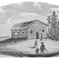
In 1628, Thomas Purchase became the first European to permanently reside on the Androscoggin when he was granted land at the present site of Brunswick. There, he built a fortified trading post and carried out an extensive trade with the Abenaki…

Native American camp scene

Indian camp scene.jpg

Still Image / Available Online

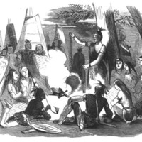
By the middle of the 17th century, the traditional Indian way of life along the Androscoggin was undergoing drastic change. An attitude of friendly curiosity turned to distrust and hostility—especially toward the English—as the native population…

Fort George

Fort George.jpg

Still Image / Available Online

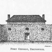
By 1673, the English had established a commercial fishing operation at Pejepscot Falls in Brunswick, catching some forty barrels of salmon and ninety kegs of sturgeon in just three weeks. To protect the lives and livelihoods of the settlers in that…

1755 Mitchell map detail

Mitchell 1755 map (detail).jpg

Still Image / Available Online

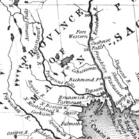
In 1714, a prominent group of Massachusetts men obtained a charter to the “Pejepscot Patent,” a huge tract of land on both sides of the lower Androscoggin River. From the relative safety of Boston, the Pejepscot Proprietors promoted the…

18th century log cabin

log cabin.jpg

Still Image / Available Online

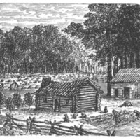
The 1760s and 1770s witnessed the clearing of land and the construction of farmsteads, houses, mills and churches as white people moved up the Androscoggin River to occupy territory long occupied by the Abenaki.

Durham, Maine lot and range map

Durham, Maine, map.jpg

Still Image / Available Online

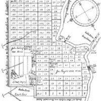
Arranged in a grid-like pattern, with the Androscoggin River on the right, this 1766 “lot and range” map of Royalsborough—incorporated as Durham, Maine, in 1789—clearly shows the narrow “intervale” lots bordering the River’s western bank. As in…

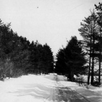
Route 2 west of Hanover

road in Hanover.jpg

Still Image / Available Online

A series of relatively level uplands running alongside rivers and streams in the Androscoggin watershed were utilized for the location of roads as towns developed and prospered. This photo shows a section of present-day Route 2 west of the village…

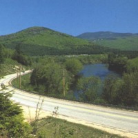
Route 2 and Androscoggin River in Bethel

Route 2 and AR at Bethel.jpg

Still Image / Available Online

A series of relatively level uplands running alongside rivers and streams in the Androscoggin watershed were utilized for the location of roads as towns developed and prospered. This photo was taken in Bethel about 1990 near the junction of Route 2…

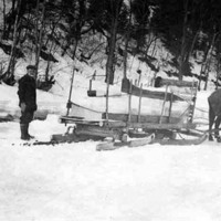
Ice cutting

IceCutting2.jpg

Still Image / Available Online

During the 18th, 19th and early 20th centuries, inhabitants of valley towns cut ice on the Androscoggin River for use in preserving foods during the hot summer months. Although ice-harvesting on the Androscoggin did not become of major commercial…

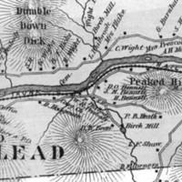
1880 map detail showing Gilead

Gilead 1880 (section).jpg

Still Image / Available Online

During the late 1840s and early 1850s, the Androscoggin River valley from Bethel, Maine, to Berlin, New Hampshire, was chosen as the best route for a railroad linking Portland with Montreal. This 1880 map (section) of Gilead, the next town west of…