Browse Items (74 total)

  • Collection: A River's Journey images
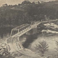
Bridge below Lisbon Falls

bridges below Lisbon Falls (taken out in 1936).jpg

Still Image / Available Online

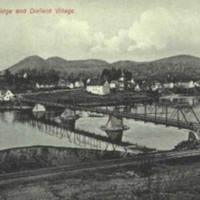
The massive stone piers supporting this bridge below Lisbon Falls were designed to withstand the Androscoggin's strong currents and the pounding of huge chunks of ice during the winter. Nevertheless, extremely high water during the flood of March…

Toll bridge between Mexico and Peru, Maine

toll bridge between Mexico and Peru, near Dixfield.jpg

Still Image / Available Online

This four-span iron toll bridge opened in 1895 between the towns of Mexico and Peru, Maine, and replaced a ferry that had long operated at this location. The West Peru railroad station (1892) was located just out of the picture on the right.

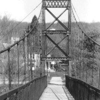
Androscoggin Swinging Bridge

Androscoggin Swinging Bridge (MHPC photo).JPG

Still Image / Available Online

The "Swinging Bridge" was originally built in 1892 for workers walking over the Androscoggin River from the Topsham Heights neighborhood to Cabot Mill in Brunswick, Maine. The bridge was constructed in 1892 by John A. Roebling's Sons Company, the…

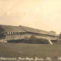
Androscoggin River covered bridge at Bethel

Androscoggin+River+covered+bridge.jpg

Still Image / Available Online

Completed in 1869, this three-span, double-lane covered bridge spanned the Androscoggin River at Bethel until it was razed in 1927. Note that the closest span was built at an angle, due to the different heights of the riverbanks.

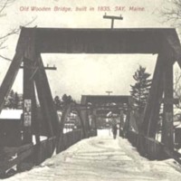
Wooden bridge at Jay, Maine

wooden bridge at Jay Bridge.jpg

Still Image / Available Online

Its open trusses and laminated arches protected from the elements by wooden shingles, this primitive bridge provided access over the Androscoggin at Jay, Maine, for nearly a century. By the time this circa 1905 postcard was issued, the bridge had…

Rumford Point Ferry

Rumford Point ferry.jpg

Still Image / Available Online

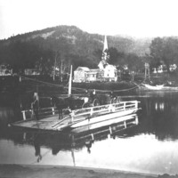
Established in 1809, the ferry between Rumford Point and Rumford Corner was the last to operate on the Androscoggin, ending service when a steel bridge was erected at that location in 1955.

Hanover Ferry model

Ferry_model.JPG

Physical Object / Available Online

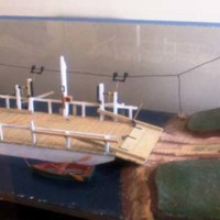
Dating from 1873, the Hanover Ferry was one-third owned by the town of Bethel, and two-thirds by Hanover. It operated on the Androscoggin River between Hanover village and East Bethel until 1934. During the 19th and first half of the 20th…

Roberts Ferry in Hanover

Roberts ferry, Hanover.jpg

Still Image / Available Online

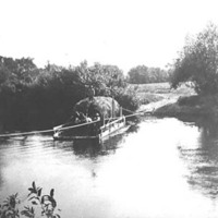
This privately-owned ferry was used for many years by the Roberts family of Hanover to access their large island in the middle of the Androscoggin.

North Star (artist's conception)

North Star (artist's conception), from HISTORY OF HANOVER by Alfred Howard.jpg

Still Image / Available Online

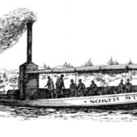
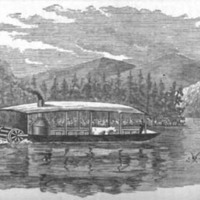
Nearly fifty feet long and capable of carrying fifty passengers, the "North Star," was launched from the Hanover ferry landing in March of 1889, and on its trial trip made it to the docking site at Alder River in Bethel. The steamboat is reported to…

Steamer "Union" on Umbagog

steamer Union on Umbagog and AR above Errol Dam.jpg

Still Image / Available Online

The stern-paddlewheel steamer "Union,” launched onto Umbagog Lake at Upton, Maine, in 1861, was the first vessel of its type to operate on the uppermost section of the Androscoggin above Errol Dam. It was also the first in a succession of steamboats…

Early view of Great Falls

early view of Great Falls with open truss bridge.jpg

Still Image / Available Online

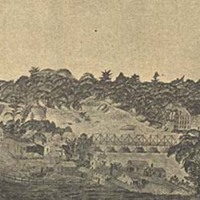
Lewiston Falls, from an 1833 painting made from the Auburn side of the Androscoggin. The open-truss bridge was erected in 1823. Following the dedicatory oration, tables were spread and a meal for the large crowd was enjoyed on the bridge.

View west from the Lead Mine Bridge at Shelburne, N.H.

West from Lead Mine Bridge.jpg

Still Image / Available Online

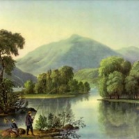
This reproduction of a print originally published by Currier & Ives about 1870, as part of the "American River Scenery" series, is identified as "View on the Androscoggin Me.," though it actually depicts a mid-nineteenth century vista looking west…

The Ferry (On the Androscoggin)

androscoggin ferry.jpg

Still Image / Available Online

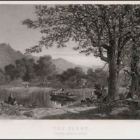
The Ferry (On the Androscoggin); Engraving, n.d. (1870s?). Though the Androscoggin was an excellent waterway for logging, its lack of shallow fords made river ferries imperative for travel and commerce. This engraving was done by William Wellstood,…

Footbridge over Androscoggin River in Gorham, N.H.

footbridge over AR Gorham.jpg

Still Image / Available Online

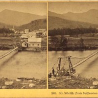
A stereoview of Imp and North Carter mountains from the Androscoggin at Gorham, New Hampshire.

Berlin sawmill

Berlin sawmills.jpg

Still Image / Available Online

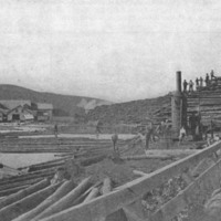
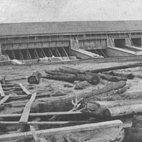
This large sawmill was erected astride the Androscoggin at Berlin, New Hampshire, in 1897 to replace one destroyed by fire earlier that year. With a capacity of 200,000 board feet a day, the mill was a thriving enterprise until it, too, burned in…

Lewiston Steam Mill Company report

Lewiston Steam Mill Co. report.jpg

Still Image / Available Online

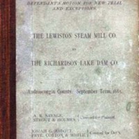
Disputes between sawmill owners and Lewiston’s textile industrialists (who controlled the company that held title to the dams on the Rangeley Lakes and the Magalloway River by 1909) were legion during the second half of the 19th century. The…

Mills at Lisbon Falls

mills at Lisbon Falls.jpg

Still Image / Available Online

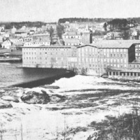
Like Lewiston, Lisbon Falls experienced an economic boom when, in 1864, a woolen mill known officially as the “Worumbo Manufacturing Company” was built adjacent to the falls on the Androscoggin. The town’s largest single employer before it was sold…

Androscoggin river dams

Upper Dam.jpg

Still Image / Available Online

The dams that confine and regulate the flow of water from the many lakes above the source of the Androscoggin River are (top to bottom) Upper Dam, between Mooselookmeguntic and Upper Richardson lakes; Middle Dam, between Lower Richardson lake and…

Farrar's 1876 map section

Farrar's 1876 map.jpg

Still Image / Available Online

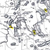
This section from Farrar’s Map of the Rangeley Lakes Region and the Sources of the Magalloway & Androscoggin Rivers (1876) has been highlighted to show several of the large dams constructed after 1853 to control the flow of water into the…

Dam construction above Berlin

dam construction above Berlin #1.jpg

Still Image / Available Online

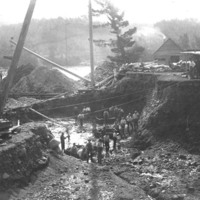
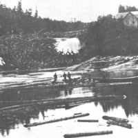
This photo, which dates from about 1900, conveys an accurate picture of the back-breaking toil involved in the construction of dams on the Androscoggin before the advent of hydraulic equipment. A handwritten note on the back of the image reads:…

Mooselookmeguntic Lake from the Height of Land

Mooselookmeguntic Lake.jpg

Still Image / Available Online

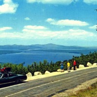
The Rangeley Lakes (including the man-made Aziscohos Lake) in northwestern Maine serve as an enormous reservoir for the Androscoggin. To regulate the flow of water in the river, and to control flooding, dams between the several lakes in this chain…

Lewiston, showing canal and mills

Lewiston, showing canal and mills.JPG

Still Image / Available Online

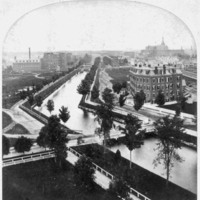
The grand plan for diverting water from the Androscoggin through a series of canals at Lewiston is well illustrated in this stereograph photo taken about 1875. Using the same water to power, a half dozen mill installations were made possible by an…

Falls at Lewiston-Auburn

Falls at Lewiston-Auburn.jpg

Still Image / Available Online

Between 1850 and 1870, Lewiston was transformed into a manufacturing center when granite-sided canals, huge brick textile mills, and rows of brick and wooden workers’ housing were constructed just below the Great Falls. The Androscoggin River was…

Log jam at Rumford falls

log jam at Rumford Falls mid-1870s.jpg

Still Image / Available Online

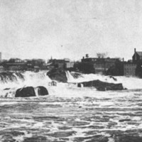
A frightening jam of long logs at the upper falls in Rumford in 1873. A newspaper article published a few years before this incident declared that log jams here were “truly a wonderful sight,” and that on one such drive four million feet of logs lay…

Androscoggin log drive

Androscoggin log drive #2.jpg

Still Image / Available Online

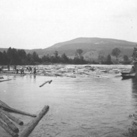
This photo of circa 1900 depicts a long log drive on the Androscoggin about ten miles downriver from Bethel Hill village. Using pick poles, peaveys, and brute strength, river drivers (many of whom could not swim) kept logs apart to prevent jamming. …