The Robertsons of “Robinson Hill”
Title
Creator
Publisher
Date
Format
Identifier
Text Record
Collection
Full Text
The Robertsons of “Robinson Hill”
By Randall H. Bennett
The origins of Bethel's early placenames, and the meaning(s) they convey, have long been a popular subject of discussion among scholars and family historians, and many of these researchers have utilized the Bethel Historical Society's extensive archival and library collections in their quest for answers. As they soon discover, the search for certain derivations can be both entertaining and frustrating. While some placenames have faded entirely from use, others have been supplanted by new designations, as population centers have shifted and older generations disappeared. Multiple names for the same location (for instance, Mt. Will Cemetery or York Cemetery), and similar names applied to more than one locality (Chapman Hill and Chapman Street) add to the confusion. As well, misunderstanding over the exact spelling and/or pronunciation of a handful of local placenames has led to changes that have found their way into common usage and—unfortunately—onto modern maps.
Take, for example, the name of Bethel's nineteenth century designed burial ground on Routes 5/35, just a few miles south of Bethel Hill village. Incorporated before the Civil War as “Woodland Cemetery,” it is frequently (and assertively) referred to as “Woodlawn Cemetery,” a widespread designation for many New England graveyards (including one in the nearby town of Andover). Thanks to a bronze plaque recently mounted on the façade of the Gothic Revival receiving vault at Woodland Cemetery, the correct name is prominently displayed for all who visit.
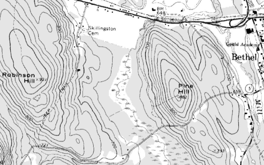
A second, and perhaps more significant, case of this type of “placename transformation” has to do with a well-known feature of the local landscape situated two miles west of Bethel Hill village. Labeled incorrectly as “Robinson Hill” on contemporary maps—both online and in print—this low mountain over which Route 2 passes is, in point of fact, “Robertson Hill,” and received its name for Samuel Robertson (1784-1847), who purchased and occupied the hilltop farm there originally cleared by Bethel‘s first blacksmith, Oliver Fenno. Samuel Robertson‘s son, Sylvester Robertson (1815-1905), grew up on his father's farm and by the mid-19th century was one of the town‘s most successful cabinet-makers. Speaking of the younger Robertson in his 1891 History of Bethel, Dr. William B. Lapham remarked, “He has always lived here, and is as well posted on Bethel and the Bethel people of his time, as any one in town. . . . Many apprentices have learned the cabinet-maker's art in his little shop, and if they did not learn it thoroughly it was their own fault.”
Census and cemetery records confirm that “Robertson” retained its place as a well-known Bethel surname until around World War II. Since that time, the gradual disappearance of the name in the community, combined with the more omnipresent (and easier to say) surname Robinson, has resulted in the near-universal tagging of this geographic location as “Robinson Hill.” However, one can hope that the publication of this article may once again turn the tide so that, in the not-too-distant future, the name “Robertson Hill” will reappear in its rightful place on maps of the town of Bethel, Maine.
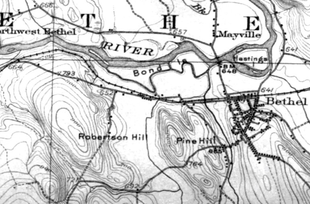
U.S. Geological Survey map, Maine (Oxford County),
Bethel Quadrangle, April 1914 edition, showing
(correctly) “Robertson Hill” (center left)