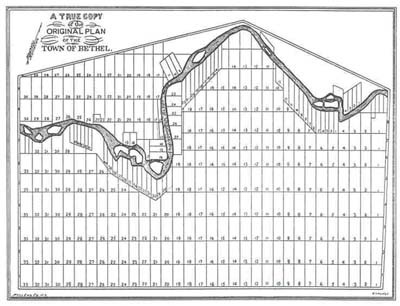
Late 1760s Bethel lot and range plan
Title
Late 1760s Bethel lot and range plan
Description
Arranged in a grid-like pattern, this "lot and range" plan of the late 1760s clearly shows the narrow forty-acre parcels of fertile "intervale" land near the Androscoggin River, which were much sought-after by Bethel's early settlers. Of this plan, one early town historian wrote, "The surveyors paid but little regard to the prescribed limits of six and three-quarter miles square. They extended their survey along the river in order to include all the good interval [sic] possible, for a distance of more than fifteen miles."
Identifier
historic-town-01

