Indian Raid map
Title
Indian Raid map
Creator
Description
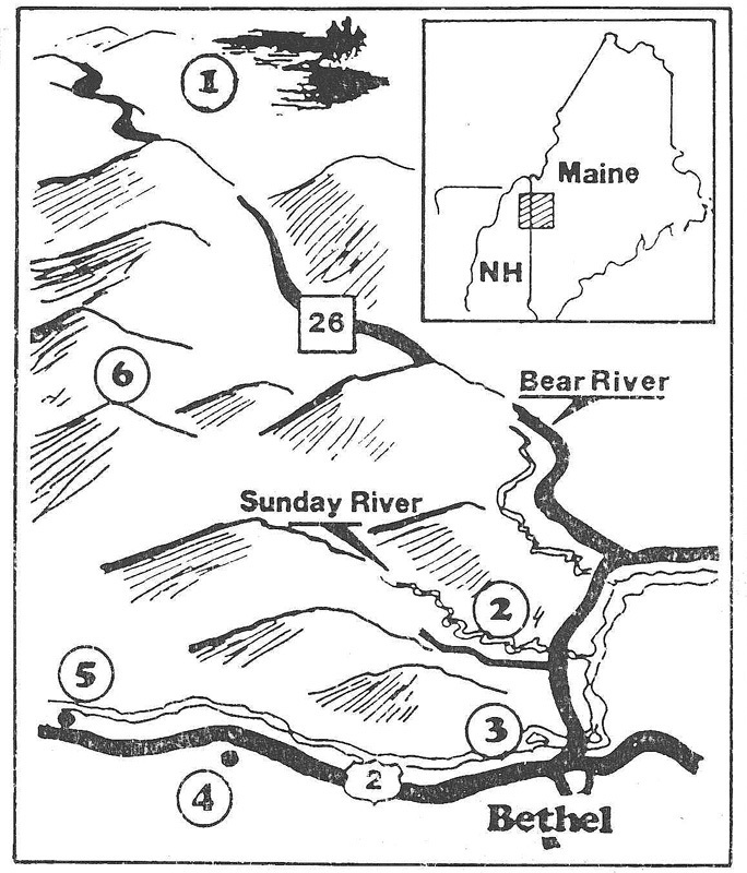
This map pinpoints sites connected with New England's Last Indian Raid of August 2-3, 1781: (1) Indians venture south from Umbagog Lake; (2) Barker homestead on Sunday River attacked; (3) Captives taken at Clark house in Bethel; (4) Gilead settler killed and scalped; (5) Shelburne settler killed and another captured; (6) Indians and captives flee over Mahoosuc Mountains to Canada. Tumkin Hagen, leader of the raiding party, also intended to kill Colonel Clark, camped in the vicinity, but Molly Ockett warned the Boston man in time to save his life.
Original Format
Map
Identifier
mollyockett-23

