Picturesque and Often Grand: The Androscoggin Valley
The scenery of the Androscoggin River valley, especially upriver of Rumford Falls where the River flows through a section of the Appalachian Chain of mountains, has inspired painters, photographers, writers and poets for some two centuries.
Regarding the importance of the Androscoggin valley as a route through the Appalachian Mountains . . .
The quickest access to the White Mountain range itself is gained by the valley of the Androscoggin. This noble river flows by the extreme easterly base of that range, where the forms are the most noble and imposing. Within a very few miles of the foot of Mount Washington, it receives the Peabody River, which issues from the narrow Pinkham Pass between Mount Carter and the White Mountains [Presidential Range]. This stream is supplied in part from the southeast slopes of the highest mountains of the chain, and is often swollen into a tremendous torrent by the storms, or the heavy and sudden showers that drench their sides. It is the Androscoggin which has engineered [a place] for the Grand Trunk Railway, that connects Portland and Montreal, the St. Lawrence with the Atlantic. That Company are indebted to it for service in their behalf that was patiently discharged centuries before Adam.
— Rev. Thomas Starr King, The White Hills: Their Legends, Landscape, and Poetry (1859)
"The Androscoggin is a beautiful river, and the scenery bordering upon it is picturesque and often grand. Persons born and reared upon its banks have an attachment for it which is never weakened in after years, however distant they may wander and whatever may be the lapse of time. Its broad intervales, decorated here and there with drooping elms, rising into table lands with sunny slopes and backed by wooded hills or craggy mountains, make up a succession of vistas which become indelibly stamped upon the memory."
— William B. Lapham, History of Rumford, Oxford County, Maine (1890)
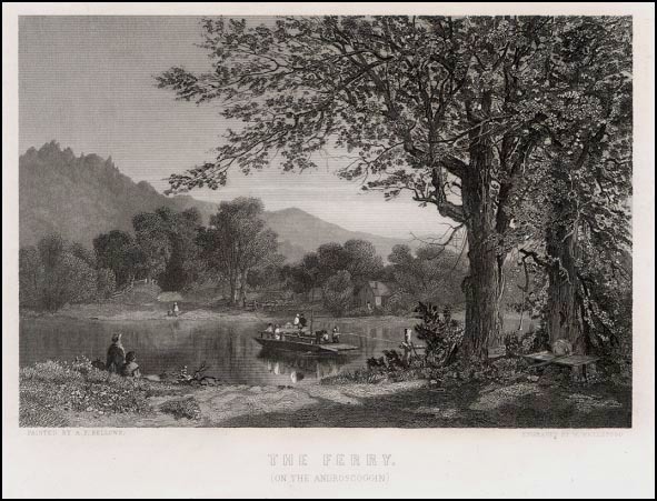
The Ferry (On the Androscoggin); Engraving, n.d. (1870s?). Though the Androscoggin was an excellent waterway for logging, its lack of shallow fords made river ferries imperative for travel and commerce. This engraving was done by William Wellstood, after a painting by Albert Fitch Bellows.
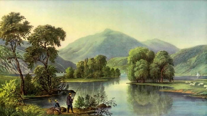
This reproduction of a print originally published by Currier & Ives about 1870, as part of the "American River Scenery" series, is identified as "View on the Androscoggin Me.," though it actually depicts a mid-nineteenth century vista looking west from the Lead Mine Bridge at Shelburne, New Hampshire. Of this famous view, a writer in the Boston Traveller in 1897 stated, "It is one of the loveliest pictures not only in the White Mountain region, but anywhere in the world, so impressive is the beauty of the river and the island and the bold symmetry of the mountains." The construction of a power plant and water control dam by the Brown Company early in the last century submerged the islands and changed the view, though the bare peaks of Mts. Madison, Jefferson and Washington still tower grandly in the background.


